
iTunes Preview
| I did not create this app. A company called PocketWings, LLC did. Here is a link to them, but as of 02JUN16 it is an abandoned shell from which everything has been purged. |
| 20JUN20. BUG OR FEATURE? If you have The Goblin, fly it straight into the river (or maybe also the ground!?!) and you're still flying "underwater!" You can then "fly" it back up above ground and into the air again. (Thanks to D.H. for discovering—and sharing—this tip!) |
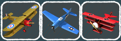
| 15JUN16. NEW VERSION. I have been ignoring my App Store notifications and so was unaware of the big update back in May. An even newer update is available as of 2 days ago. Here are the significant changes as I have experienced them: 13 total new planes. (Description page says 19 new planes; no clue where to find the other 6.) The classic 5 are free, and today the McDonnell XF-85 Goblin was free. Here are the rest of the new planes, in the order they appear in the selection menu after the C-130 (in-app prices are listed, but after I bought the Eclipse the other prices were 5¢ lower): - Bombardier 415 Superscooper, fire-fighter!(99¢) - Extra EA300S. (99¢) - Pitts S-2C. (99¢) - Mitsubishi A6M2 Type 0 M21, yep, that's a Zero! ($1.99) - Vought F4U-10 Corsair, no introduction necessary. ($1.99) - Berkut 360, light, experimental, canard stabilizer. (99¢) - Lockheed P-38F Lightning, no introduction necessary. ($1.99) - Eclipse 550, small business jet. (99¢) - Short SC.7 Skyvan, Irish-made cargo plane. (99¢) - Mikoyan-Gurevich MiG15, one of the very first swept-wing jets. ($2.99) - Grumman OV-1D Mohawk ($1.99) - McDonnell XF-85 Goblin, very small single-seat jet dropped from a B-36 bomber. Only 2 prototypes were made. (Not sure of price, I got it free 6/15/16) - Messerschmitt Me 262 A-1a. ($1.99) No more bridge paint-jobs. I flew the Sopwith Camel under the bridge and got no new paint job. You can select the alternate paint jobs when you select the plane now. New instruments/controls. - New airspeed indicator is almost too small on my iPhone to be read, but I bet it looks good on an iPad! - Brakes. No more long rollouts. - Cockpit view in the Hellcat. (Don't know if any others have it, though I only have the classic 5 and the Goblin. I'd be surprised if the other fighters didn't have it.) Will comment more as I learn more. |
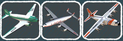
| wingspan | ft | m |
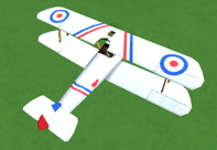
| Sopwith Camel | 27.99 | 8.53 |
| Hellcat | 42.85 | 13.06 |
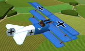
| Dr.I | 23.62 | 7.2 |
| DC-3 / C-47 | 95.01 | 28.96 |
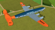
| Constellation | 123.0 | 37.49 |
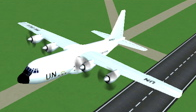
| C-130 | 132.55 | 40.4 |
 everything you do is entered into the game's five-minute memory cache, and can then be either viewed again by you, or even recorded into a stand-alone movie.
 many times to speed back to the point where your coolness began and either:
 ) or
) or  ).
). This will overwrite your beautiful pattern of course, so be careful: if you want to watch it or record it, DO NOT TAP THE FLY BUTTON, OR ELSE THE THING YOU WANT TO WATCH OR RECORD WILL BE GONE.
).
). This will overwrite your beautiful pattern of course, so be careful: if you want to watch it or record it, DO NOT TAP THE FLY BUTTON, OR ELSE THE THING YOU WANT TO WATCH OR RECORD WILL BE GONE.
| VERY COOL: This DO OVER option is INFINITELY HANDY. Say you want to try a difficult maneuver (flying under a bridge, say) and you crash during the attempt. Simply touch the screen to stop, tap REWIND a few times, and give it another shot by tapping the FLY button! And when you fail again :-) do it over again! And again after that. Seriously, this DO OVER ability is one of the cooler things about Pocket Wings! |
 . That will clear the cache and send you back to the start position in a Sopwith Camel.
 button twice quickly to activate the Multitask Menu, and then close PocketWings
  from the Multitask Menu...that WILL fully quit PocketWings and clear the flight cache.